Randonnée Cheval La Celle-Saint-Cyr - Géro.Etape3 - Photo
 aucamus
aucamus

Utilisateur

© OpenStreetMap contributors
Longueur
Longueur
24 km
Altitude max
Altitude max
223 m
Dénivelé positif
Dénivelé positif
272 m
Km-Effort
Km-Effort  
27 km
Altitude min
Altitude min
95 m
Dénivelé négatif
Dénivelé négatif
183 m
Boucle
Boucle
Non
Date de création :
2019-05-27 14:31:25.071
Dernière modification :
2019-05-27 14:31:25.28

(0 Avis)

Cheval
Cheval
3h28
Difficulté : Très facile

Scannez ce code QR pour ouvrir la randonnée dans l'application SityTrail

Application GPS de randonnée GRATUITE

Logo SityTrail SityTrail

IGN / Instituts géographiques

Télécharger SityTrail sur l'App Store Télécharger SityTrail sur Google Play

Logo SityTrail SityTrail World

Le monde est à vous

Télécharger SityTrail sur l'App Store Télécharger SityTrail sur Google Play Télécharger SityTrail sur Huawei AppGallery

À propos

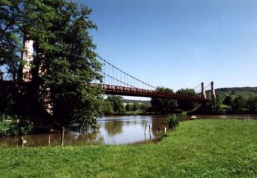
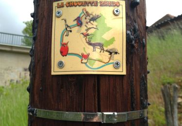
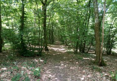
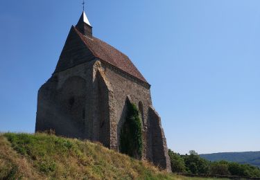
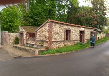
Randonnée Cheval de 24 km à découvrir à Bourgogne-Franche-Comté, Yonne, La Celle-Saint-Cyr. Cette randonnée est proposée par aucamus.

Description

La Celle St Cyr - St Martin sur Ouanne

Profil altimétrique

Localisation

Pays :
France
Région :
Bourgogne-Franche-Comté
Département/Province :
Yonne
Commune :
La Celle-Saint-Cyr
Localité :
Unknown
Départ:(Dec)
Départ:(UTM)
521352 ; 5314265 (31T) N.

Randonnées à proximité

Randonnée V.T.T. Cézy - Rando VTT de Cézy - Photo
V.T.T.
tracegps

V.T.T.

Difficile
(1)
Cézy, Bourgogne-Franche-Comté, Yonne, France
41 km | 49 km-effort
2h 30min
Oui
Randonnée Marche Cézy - Thèmes 9 Km - Photo
Marche
mesnyjy

Marche

Moyen
(1)
Cézy, Bourgogne-Franche-Comté, Yonne, France
9,1 km | 11,6 km-effort
2h 29min
Oui
Randonnée Moteur Villecien - rando villecien-beon - Photo
Moteur
jeremy89

Moteur

Très facile
(1)
Villecien, Bourgogne-Franche-Comté, Yonne, France
32 km | 38 km-effort
Inconnu
Non
Randonnée Marche Villevallier - Chouette Rando - Photo
Marche
pikibangi

Marche

Moyen
(1)
Villevallier, Bourgogne-Franche-Comté, Yonne, France
9,7 km | 11,3 km-effort
3h 0min
Oui
Randonnée Marche Villevallier - Villevallier-Saint Aubain - Photo
Marche
Yannick89

Marche

Moyen
Villevallier, Bourgogne-Franche-Comté, Yonne, France
16,7 km | 20 km-effort
4h 7min
Oui
Randonnée Marche Verlin - Verlin 230625 - Photo
Marche
Specialized77

Marche

Facile
Verlin, Bourgogne-Franche-Comté, Yonne, France
11,3 km | 13,5 km-effort
5h 43min
Oui
Randonnée Marche Saint-Aubin-sur-Yonne - Saint Aubin - Photo
Marche
pikibangi

Marche

Moyen
Saint-Aubin-sur-Yonne, Bourgogne-Franche-Comté, Yonne, France
9,8 km | 11,9 km-effort
2h 4min
Oui
Randonnée Marche Cézy - cezy 26 8 2019 - Photo
Marche
robjor1946

Marche

Très facile
Cézy, Bourgogne-Franche-Comté, Yonne, France
8,6 km | 9,3 km-effort
2h 55min
Oui
Randonnée Marche La Celle-Saint-Cyr - Les foulons-Le moulin d'en bas  - Photo
Marche
papyjv8991

Marche

Facile
La Celle-Saint-Cyr, Bourgogne-Franche-Comté, Yonne, France
5,2 km | 6,4 km-effort
1h 41min
Oui


Fermer
Mes abonnements